


X-Marks-The-Spot app for iPhone and iPad
Developer: X-Avionics, LLC
First release : 17 Dec 2012
App size: 5.2 Mb
Sometimes maps just get in the way.
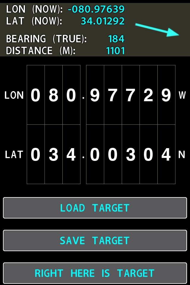
Maybe you want go somewhere for which there is no address, guided by a simple arrow pointing the way, showing distance to go there.
-Your parked car in a huge parking lot after it has been there for a week.
-A small airport FBO or any other location where the maps for it are just plain wrong, or the net access too slow to rapidly load.
-A friend who is off the grid camping, and can give you only his latitude and longitude.
-A hiding place or rendevous location not at ANY street address.
-A location in the middle of nowhere where a model rocket or airplane that transmits telemetry has landed or crashed.
-A location in the middle of nowhere where a friend that can give only his latitude and longitude has landed or crashed.
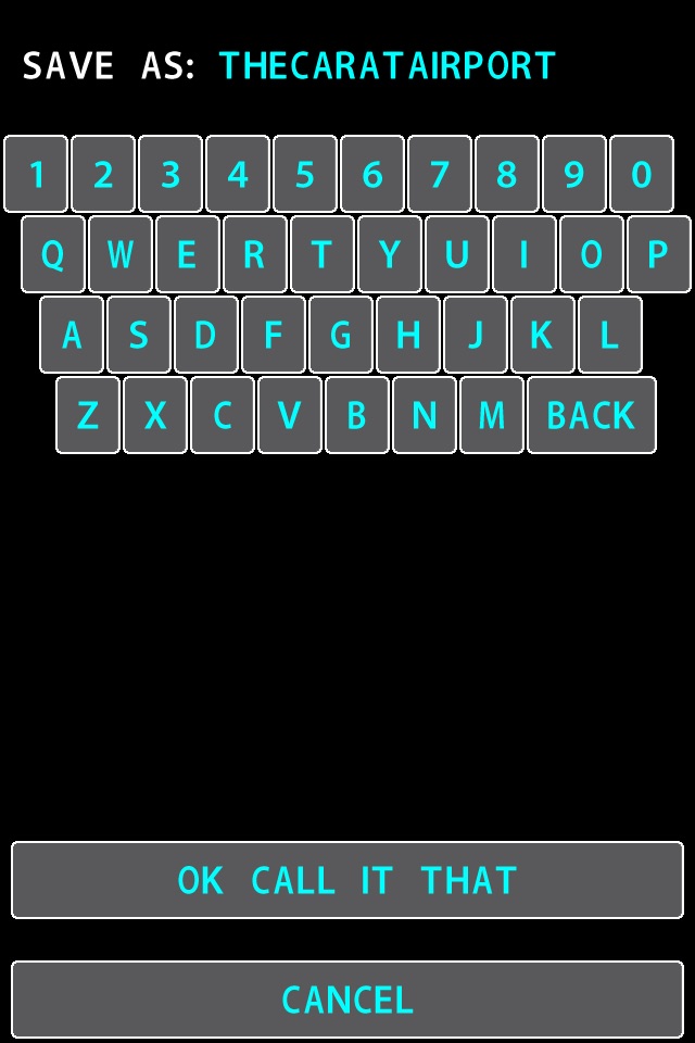
You just want to MEMORIZE a location so you can get back to it later, or enter the latitude and longitude of any location so you can get to it now, and simply have an arrow point you there like a divining rod that also shows distance still to go.
THIS app does THAT.
And nothing else.
So it is 99 cents, bug-free, and as fast and easy to use as any app could be. THIS is the app you want when you just want an arrow to point you to a desired location, and thats it.
Works on phones and pads.
Latest reviews of X-Marks-The-Spot app for iPhone and iPad
meh ... its "OK", but not having distances converted to other than KM is a dumb oversight ... as well as not allowing "landscape" orientation for iPads.
Does exactly what it says it will do. I parked my car in a large lot for a bit of Christmas consumerism, marked its location with X-M-T-S, and the app led me to within a few spaces of my vehicle. Thanks Austin!
Program works as advertised, but it set my brightness on 4s to full every time it is run. Not exactly handy.
Youd have to sit up long nights to make this app any simpler. Use it to mark any spot--tap "right here"--and you know the direction, distance and elevation to get back. Very handy, very simple, very fun! You can put in coordinates if you have to, and of course you read off the coordinates of the spot you tapped in. Cool!
Agree with corky37. The program resets the brightness level to max when run. Should be an easy fix...